
This post is part of our series on our favorite homeschool resources.
National Geographic Mapmaker 1-Page Maps is my favorite map resource. I predominantly use it for geography and history, but I occasionally print out maps for other subjects as geography plays a natural role in almost all areas.
Mapmaker allows you to create customized world, continent, and country maps. For the US, Mexico, and Canada, you can also make state and province maps.
Creating Maps
I usually create two maps: a Labeled Map and an almost completely Blank Map. The former I give to the kids to study and for spelling; the latter is for them to fill in with help of the labeled map and any additional resources we might be using for a given subject.
When I make the Labeled Map, I usually use the default map which includes everything. However, depending on the purpose of the map or the age of the student, I will also make simplified maps and only include some of the elements.
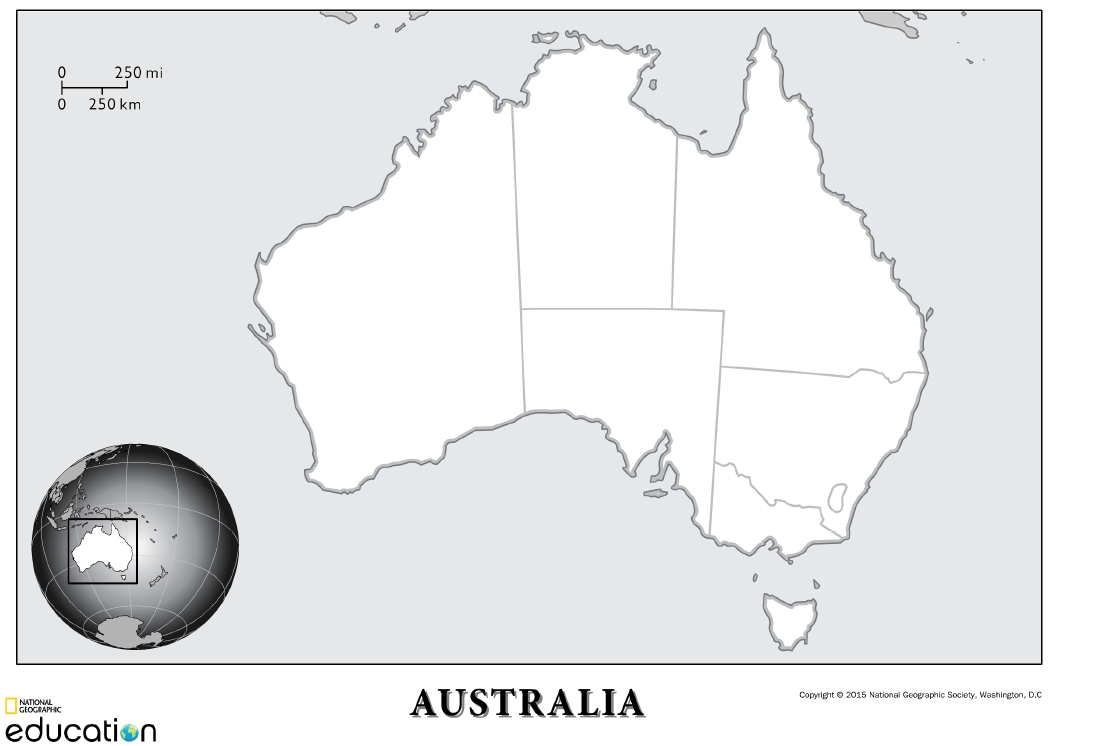
When I make the Blank Map, I choose to include Map Title, Locator Map, Country and/or State/Providence Boundaries. I deselect all other elements.
There are many elements, and the program is worth exploring. There are several options for saving the map, and I prefer to download the maps as PDFs.
One downside is the disclaimer at the top:
The maps in this interactive were last reviewed in 2011. Please consult a copy of the 10th Edition of the National Geographic Atlas of the World for the most up-to-date version.
Example Maps
Below are example maps from a recent study of Australia and its kangaroos. They are the Labeled Map, the Blank Map, and Two Maps completed by my children. For this lesson, we used an additional resource of a National Geographic magazine article to label the territory of various species of kangaroos.


I use these maps for all ages, but I change my expectations and what I require of the kids based on their ages and abilities. I will go more into this in a future geography resource post.


You may learn more about Dawn on the CMER speaker page.
Leave a Reply